John Rock (6-mile loop)
1 of 6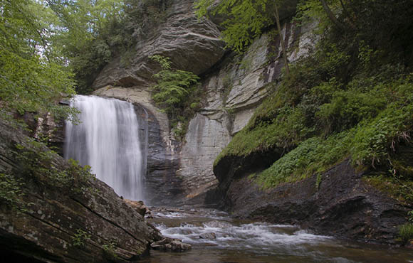
The trailhead to John Rock shares a parking lot with the Pisgah Wildlife Education Center, a great place to pop in to before or after you finish your hike (there's a gift shop and a wildlife education center to check out). Follow the red blazed trail across Cedar Rock Creek and up, eventually reaching an elevation of 3,354 feet. From the top of John Rock, you're rewarded with a beautiful view of Looking Glass Rock and an endless panorama of Pisgah National Forest. Take caution on the slippery granite, though—it's a 200-foot drop to the floor below.
Shining Rock (8.5-mile loop)
2 of 6
This difficult hike in the Shining Rock Creek Wilderness area will work your legs but reward you with beautiful views. Because trails in the Shining Rock Creek Wilderness are not marked, it will also work your navigational skills. Make sure to bring a map and compass. The trail begins at the Big East Fork Trailhead and cuts through forests of maple, oak and beech before eventually moving into green spruce and fir tree territory. From the top of the trail, you'll see Pisgah Ridge, Tennent Mountain and the Middle Prong Wilderness Area. Of course, you'll also find the shining quartz rocks for which the trail is named.
Looking Glass Rock (6-mile out and back)
3 of 6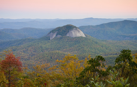
Looking Glass Rock is a celebrity of sorts on the Blue Ridge Parkway, a bald, exposed rock face visible from the parkway but only accessible to those hardy enough to climb there. Located in Pisgah National Forest, the rock rises 1,700 feet from the valley floor. The trail to the top winds through flowering rhododendrons and dense forest and is well marked and accessible all year long. If you can, make the climb in all seasons, as each month the forest reveals a different piece of itself.
Black Balsam Knob (5.2 mile loop)
4 of 6
The trailhead to Black Balsam can be found at the end of Black Balsam Knob Road. Begin your hike on the Ivestor Gap Trailhead before joining up with the Art Loeb Trail. Though the view from the top of Black Balsam is worth the effort, great glimpses of Sam's Knob and the Middle Prong Wilderness, as well as views of Asheville and Great Smoky Mountain National Park, are all visible from the trail. When you've reached the top, take a rest on the rocks and enjoy the view of the ancient Blue Ridge Mountains (they're over a billion years old!).
Graybeard Trail (9.5 mile out and back)
5 of 6
Located in the town of Montreat, the Graybeard Trail is a strenuous 9.5-mile trail that offers some of the best long-range views in the Blue Ridge. Marked by blue diamond blazes, the trail begins in a grove of hardwood forest. After nearly 1.5 miles of climbing, the views of the Black Mountains and other Blue Ridge ranges come into view. From the top of Graybeard Trail you are rewarded with views of Mount Mitchell, the highest peak in the state of North Carolina. Tackle this hike in the autumn, when the fall leaves are at their finest.


Discuss This Article